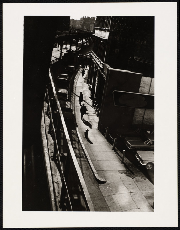
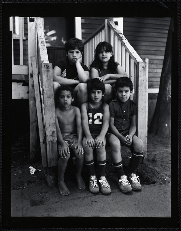
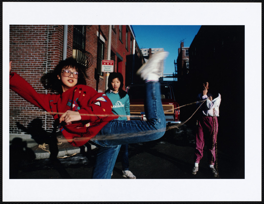
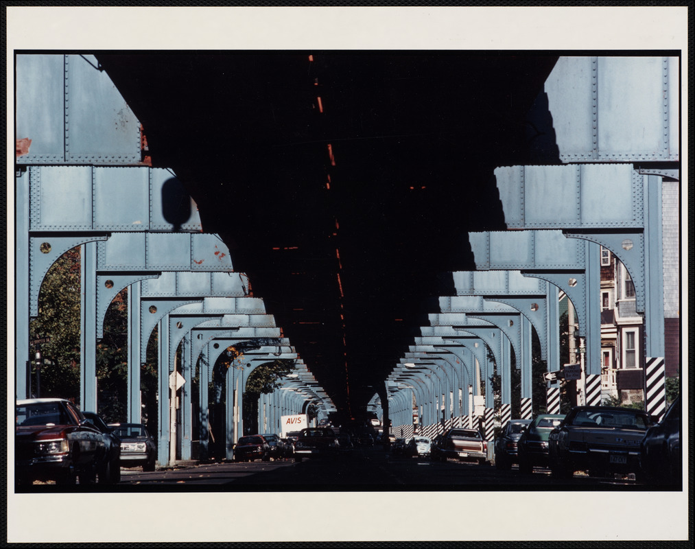
Clockwise from top left: Washington Street, Roxbury from a moving elevated train; Along the El; Elevated subway supports, Jamaica Plain; Chinese jump rope, Chinatown, Boston. All images from Along the Elevated: Photographs from the Orange Line at the Boston Public Library.
From 1901 to 1987, the MBTA’s elevated Orange Line ran between Chinatown, the South End, Roxbury, and Jamaica Plain. In 1985, with the demolition of the elevated line looming near, pairs of professional and student photographers set out to document the interconnected people and places that existed along the Orange Line. Over the course of the two-year project, they created a collection of hundreds of photographs that documented the Orange Line’s neighborhoods using different visual and conceptual styles while building an invaluable historical archive of a city in transition.
The project’s impetus began in the 1980s when a proposal to build a federal highway running between Boston’s South and West neighborhoods was met with staunch opposition from the inhabitants of these neighborhoods. The grassroots movement to stop the construction of the highway was successful, but the planned demolition of the elevated portion of the Orange Line to make room for the highway continued.
In anticipation of a change that would geographically and socially shift the lives of Bostonians living and traveling along the Orange Line, a new non-profit organization set out to create a time capsule for the MBTA. The project was organized by UrbanArts, whose mission is to implement public art and unify artists in Boston’s underserved communities.
The resulting photographs range from still and lively, architectural to organic, and personal to removed. Despite their diversity, many of the images pay close attention to often-ignored aspects of life along the Orange Line, noting the drama in the details. A black-and-white photograph taken from a moving, elevated train catches pedestrians as they walk below on Washington Street in Roxbury (above, top left). A street-level image taken directly below the elevated line shows newer means of travel carrying on below the sturdy foundations of the Orange Line (above, bottom right). These photographs juxtapose the old and the new, as modern vehicles and commuters move alongside train tracks built in the early 1900s.
Other images focus on local residents who live along the Orange Line. In Along the El, documentary photographer John Leuders-Booth centers five young Bostonians as the subject of his portrait (above, top right), their stillness at odds with the activity one expects of children. In a more vibrant and lively scene, Lou Jones captures a split-second moment as three girls jump-rope in the streets of Chinatown (above, bottom left). By including portraits of children in the project, Leuders-Booth, Jones, and other photographers affirm the role young people play in the life and livelihood of the Orange Line and the neighborhoods it connects.
As much artistic experiment as time capsule, Along the Elevated: Photographs of the Orange Line presents this urban transportation system through different aesthetic and conceptual lenses. The project demonstrates how the Orange Line’s elevated tracks and trains connect the myriad lived experiences of residents and commuters alike. Today, the collection serves a visual record of Boston’s transportation system at a point of change, making it a resource for educators, researchers, and anyone curious about the city’s history.
-Jeanne Bedard, Wheaton College (Norton, MA), Class of 2022
Bibliography
Phalen, Margaret under the supervision of Eve Griffin. 2014. Finding Aid for UrbanArts, Inc. Records, 1970-2014. Boston Public Library: http://archon.bpl.org/?p=collections/findingaid&id=92&q=&rootcontentid=46904
Along the Elevated: Photographs of the Orange Line. Digital Commonwealth: https://www.digitalcommonwealth.org/collections/commonwealth:mp48vj12x